Stratos: Redefining Geospatial Intelligence
Instant Insight, Global Reach
Coming In 2029!
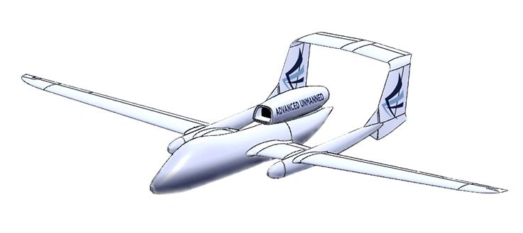
Advanced Unmanned’s mission is to deliver real-time geospatial intelligence with unmatched precision and global scale, empowering decision-makers to act decisively in critical moments. Through Stratos, our jet-powered HALE platform, we provide a multi sensor suite—including high-resolution 10 cm optical, SAR, thermal, and hyperspectral data—within 5–10 minutes, redefining how the world responds to security, infrastructure, and environmental challenges—anytime, anywhere.
Stratos delivers 5-minute, 10cm ISR to secure borders, preventing thousands of breaches satellites miss by 24 hours.
Real-time surveillance of power grids cuts outage response from 24 hours to 10 minutes, protecting millions of customers
Stratos’ 5–10 minute wildfire detection with all-weather SAR protects thousands of acres, outpacing satellite delays
Urban and transport imagery in 10 minutes optimizes thousands of projects—satellites can’t match the speed.
Stratos’ crop data delivered instantly enhances yields across millions of hectares, beating 24-hour satellite updates.
Real-time shipping lane surveillance secures thousands of vessels daily, 100x faster than satellite alternatives.
5-minute 3D traffic and airport insights eliminate hours of delays—Stratos leaves 24-hour satellite data behind.
Stratos’ instant flood and quake data saves hours of critical time, rendering satellite imagery obsolete.
Real-time pipeline and exploration surveillance prevents spills and optimizes operations across thousands of kilometers, surpassing satellite delays
We use cookies to analyze website traffic and optimize your website experience. By accepting our use of cookies, your data will be aggregated with all other user data.